Funded by the New Zealand Government Smart Idea grant UOWX2103, (2021-2024).
LERNZ researchers: Deniz Özkundakci (lead), Tadhg Moore, Chris McBride, Moritz Lehmann, Mat Allan, Whitney Woelmer, Maggie Armstrong, Matthew Prentice and Ian Kusabs, with support from national and international collaborators.
The platform integrates data from Regional Councils, NIWA, Freshwater Ecosystems of New Zealand (FENZ), and Land Information New Zealand (LINZ), alongside satellite remote sensing, to enable scenario simulations for up to 1,500 lakes. This allows lake managers and researchers to:
- Assess individual lake models within a regional and national context.
- Identify lakes at risk of degradation and prioritise restoration interventions.
- Evaluate the impacts of climate change and nutrient load reductions on water quality.
LERNZmp ecosystem modelling platform
Data integration and model development
- Climate: The platform automates access to meteorological inputs, using NIWA’s CliFlo database and Copernicus ERA5 reanalysis data. This ensures that the models incorporate high-quality climate information, essential for accurately simulating ecosystem processes.
- Lake and catchment characteristics: Water quality datasets from more than 140 lakes were sourced from regional councils, including data on temperature, dissolved oxygen, nutrients (nitrogen and phosphorus), algae biomass (as chlorophyll-a), and water clarity (Secchi depth). Nutrient load estimates were also generated using the CLUES model for catchments with sparse data, ensuring consistent nationwide coverage.
- Bathymetric surveys: Comprehensive bathymetric maps were digitised for 173 lakes. These maps were compiled from scanned NIWA maps, side beam surveys conducted by regional councils, community-sourced data (via C-MAP), and published literature. The project also updated lake depth values for 300 lakes using new data from regional councils and other research programmes such as Lakes380.
- Satellite remote sensing: For approximately 1,200 lakes, satellite-derived estimates of chlorophyll-a and skin water temperature (dependent on cloud cover) were used to validate model outputs and provide insights for lakes lacking in-situ measurements.
- Innovative Modelling Tools – Two R packages, Aquatic Ecosystem Model Ensemble (AEME) and AEMEtools, were developed to simplify the modelling workflow. These tools standardise input and output processes, facilitate model calibration, and integrate geospatial and meteorological data sources.
Application accessibility
The platform is accessible to a broad range of users, including scientists, policymakers, iwi, and community groups. It allows users to:
- Explore lake-specific outputs to assess water quality and ecological health.
- Simulate management scenarios, such as nutrient reduction targets or restoration strategies, and evaluate their outcomes.
- Investigate climate change impacts, including how changes in temperature and precipitation affect lake water quality and ecosystem health.
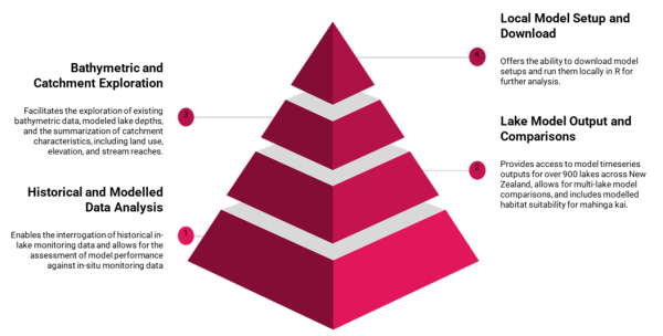
Interactive tools for lake analysis and model data
Tools
- Access LERNZmp to interact with the modelling platform and see more detail.
- Use the Chlorophyll-a monitoring dashboard using satellite remote sensing to fully utilise the modelling platform and access additional tools.
- The Aquatic Ecosystem Model Ensemble (AEME) package allows you to setup and run an ensemble of aquatic ecosystem models.
- AEMEtools is designed to work with AEME. It contains a range of functions to assist in setting up simulations for a lake site.
- Lake bathymetry digitiser
- Lake shoreline digitiser