The University of Waikato is expanding research into marine darkwaves, periods of extreme underwater darkness that can disrupt coastal ecosystems and threaten species that rely on sunlight.
A second deployment of underwater light sensors has taken place in Waihau Bay, Te Whānau-ā-Apanui rohe in the Eastern Bay of Plenty, to build a clearer picture of how these events affect New Zealand’s coastal environments.
The work forms part of the Ministry of Business, Innovation and Employment-funded programme, Toka Ākau Toitū Kaitiakitanga, which examines the effects of environmental stressors such as sediment discharges from land. The programme is led by marine researchers Professors Chris Battershill (University of Waikato) and David Schiel (University of Canterbury).

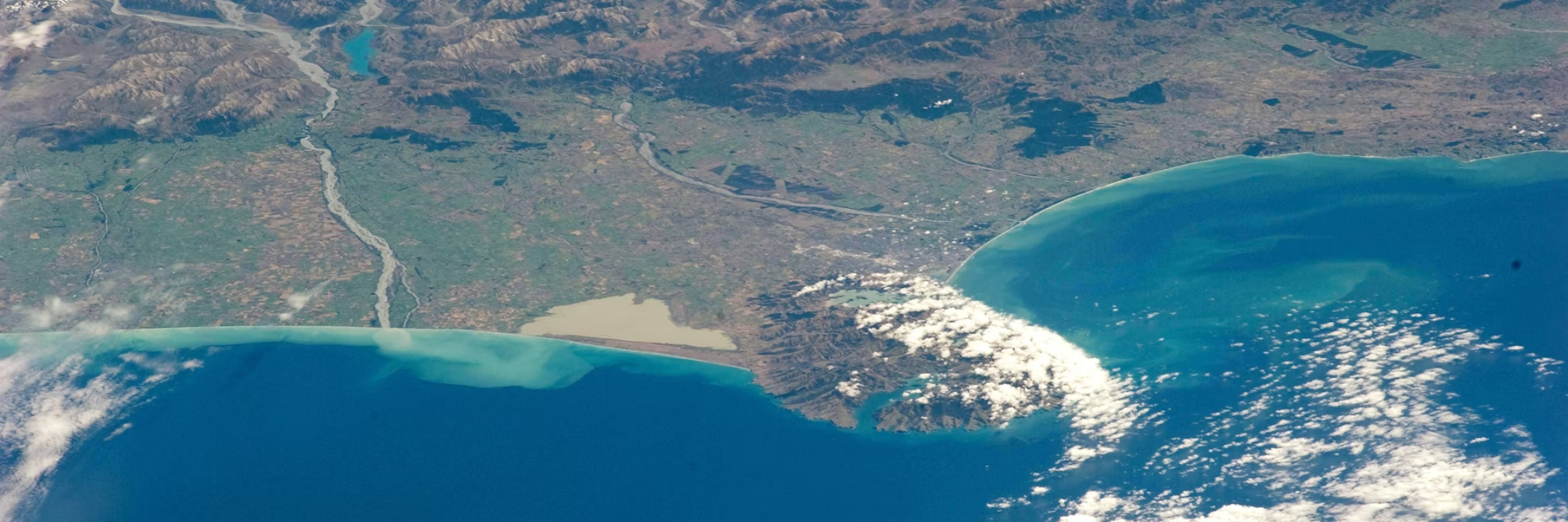
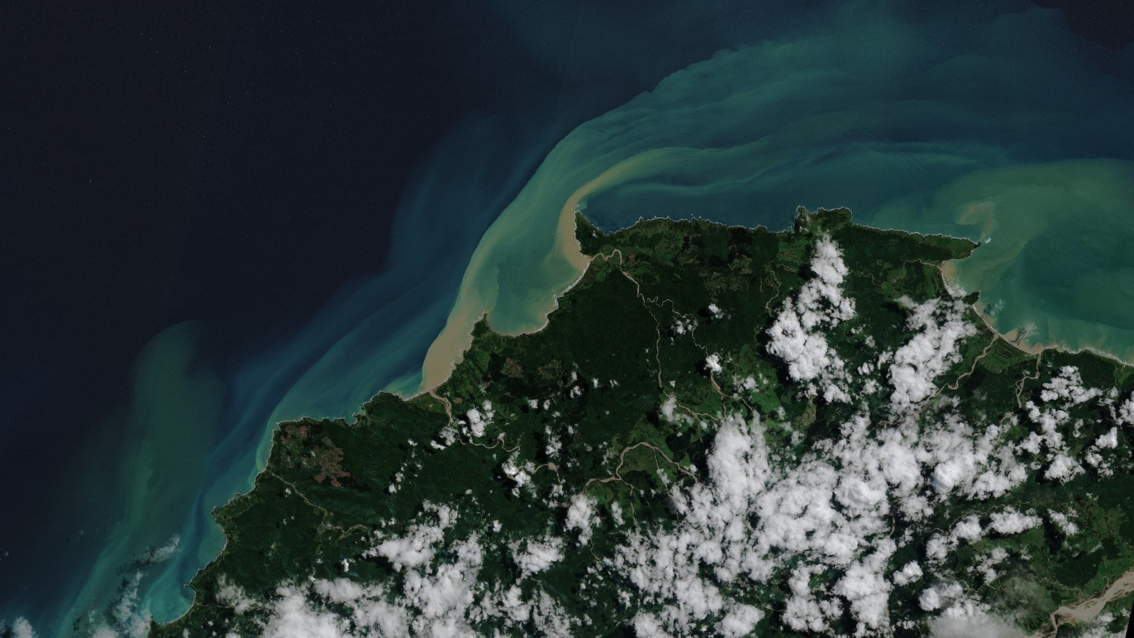
Satellite image (Sentinel-2) showing the Raukokore River sediment plume in Waihau Bay after Cyclone Gabrielle, 14 February 2023.
Dr François (Frankie) Thoral leads the marine darkwave research team and has deployed six light array sensors along the Eastern Bay of Plenty coast to track seasonal patterns and the intensity of marine darkening events caused by sediment clouds blocking sunlight from reaching reefs and kelp forests. The study focuses on the Raukokore and Whangaparāoa rivers, where hapū have observed increased sediment discharge into the moana in recent years.
The first deployment earlier this year confirmed that underwater light levels can drop dramatically after heavy rainfall and swell, which resuspends sediment previously carried into the ocean. These conditions highlight the vulnerability of region’s coastline to sudden and prolonged underwater darkness.
“Marine darkwaves can affect everything from kelp forests to the ability of fish and marine mammals to find food,” says Dr Thoral. “These events can disrupt entire coastal ecosystems, but until now there has been very little local data on how frequent or intense they are. By collecting long-term data, we can begin to understand the scale of the problem and support communities to respond.”
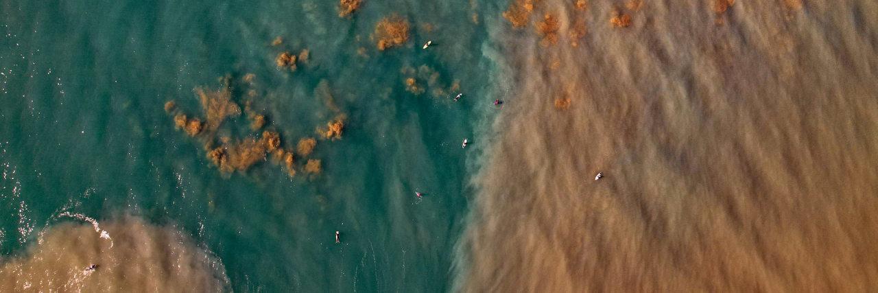
Marine darkwaves occur when sediment and debris carried by stormwater and runoff reduce underwater light levels for extended periods. Extreme weather events, such as Cyclone Gabrielle, can deliver large amounts of sediment into coastal waters, creating murky conditions that block sunlight from reaching marine plants and algae. When light is cut off for too long, kelp forests and seaweed can weaken or collapse, affecting entire food webs, including visual predators such as crayfish and snapper.
Local communities have expressed concern about the role of land use and forestry in worsening sediment runoff, which can make marine darkwaves more severe and frequent. This research aims to provide the data needed to better understand the relationship between catchment activity, storm events and marine ecosystem health.
The light array sensors record underwater light intensity and clarity in real time, providing crucial insights into how marine darkwave events evolve and how long they last. By placing sensors at multiple points along the coastline, the research team can compare how the duration and intensity of events vary across sites.
These in situ measurements complement satellite observations, which have provided long-term national-scale water clarity and sediment data dating back to 2002. “Satellites give us an excellent overview of long-term trends,” explains Dr Thoral. “But they can’t see through clouds, meaning we miss many of the extreme events. By combining satellite imagery with on-the-ground sensor data, we can fill in those gaps and create a much more accurate picture of what’s happening in our coastal waters.”
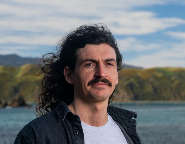
Dr François (Frankie) Thoral
Through the Toka Ākau Toitū Kaitiakitanga project, researchers are working in partnership with Te Whānau-ā-Apanui to thread scientific methods with mātauranga Māori to understand how these events affect the local marine environment and to support iwi-led environmental management.
“The coastline here is a taonga. Working alongside iwi partners means this research is grounded in both science and the lived knowledge of the community,” says Dr Thoral. “The data we collect will help inform future decisions about land use, catchment management and how we adapt to a changing climate.”
The six sensors deployed along the Waihau Bay coastline will collect continuous data over the coming months. This information will help researchers build a clearer picture of how darkwave events vary seasonally and spatially, contributing to a growing national and international understanding of how underwater darkness events shape the health and resilience of coastal ecosystems.
This work is part of a wider international research effort involving partners from Earth Sciences New Zealand, the University of Canterbury, the University of Otago, the University of Western Australia, and the University of California, Santa Barbara.