Authors provided, CC BY-SA
Authors
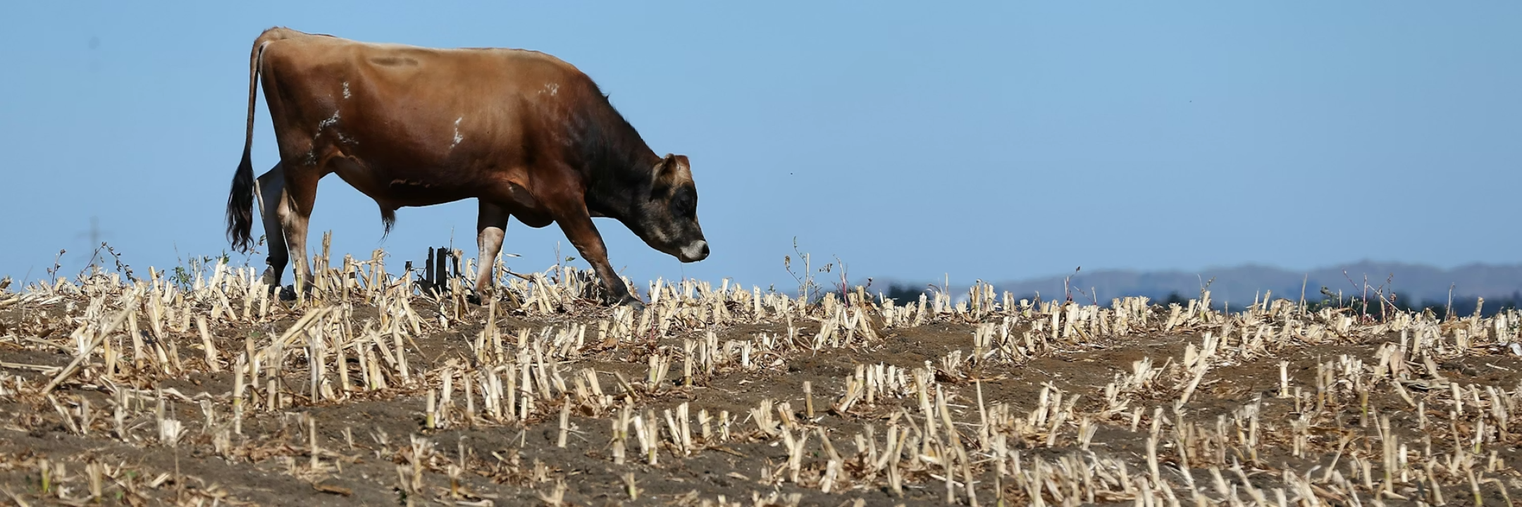
Biodiversity continues to decline globally, but nowhere is the loss more pronounced than in Aotearoa New Zealand, which has the highest proportion of threatened indigenous species in the world.
We hope our Eco-index initiative, which today launches an online ecosystem restoration map for New Zealand, will help change the story for nature.
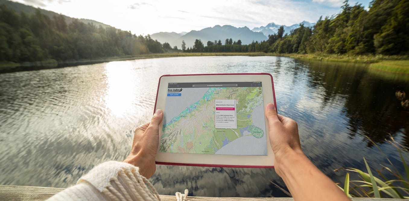
Eco-index - how it was developed and how it works.
Planning large-scale biodiversity restoration projects – whether they’re run by NGOs, governments or Indigenous groups – requires high-quality data.
Despite the rising demand, however, accessible biodiversity data have not been collected regularly or consistently. There are also challenges around the standardisation, storage and sharing of such data.
This means it has been difficult to quantify native ecosystems and biodiversity at scale. Cost-benefit analyses often have information gaps, meaning prioritising the various options for restoration projects can become guesswork.
Better data with help from new technologies
Without accurate information, improving biodiversity becomes harder. But emerging technologies – such as remote sensing and artificial intelligence – are making it easier to gather better data.
The Eco-index Ecosystem Restoration Map provides New Zealand’s first public, open-access digital tool in this area. It aims to address information gaps in biodiversity restoration, and to show users which native ecosystems are appropriate to reconstruct in any given catchment area.
It also shows where the highest restoration priorities are – such as in areas with very low native ecosystem cover. And it allows anyone to view the restoration targets for each native ecosystem in any catchment.
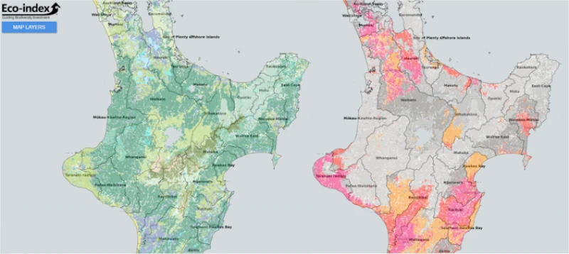
This Eco-index restoration map shows the expected natural cover of native ecosystems (left) and restoration priorities (right) in a section of New Zealand’s North Island. Authors provided, CC BY-SA
The map was developed with input from Indigenous leaders, rural professionals, community group leaders, government and industry bodies. Our goal is to share science-based information to support national discussion, policy and planning for ecosystem restoration.
It will be most useful when used alongside local information based on regional council guidance and local restoration expertise.
Ecological, economic, social and data science underpin the map’s development, as well as mātauranga Māori (Indigenous knowledge). The map will continue to be refined with data from new technologies and user feedback.
Biodiversity in policy and business
Internationally, there is growing interest in more strategic biodiversity support, including improved policy frameworks and sustainable finance.
New Zealand is addressing some national biodiversity issues through policy, such as the release of a national biodiversity strategy. The strategy encompasses three pillars, with objectives to improve systems that influence biodiversity, empower residents to take action, and protect or restore native biodiversity.
New Zealand’s National Policy Statement for Indigenous Biodiversity requires regional councils to safeguard native biodiversity and to “set a target of at least 10% Indigenous vegetation cover”.
The Eco-index has a minimum goal of 15% native ecosystem cover. It recommends land managers tackle ecosystem restoration from wherever they are now. This may mean aiming for 10% cover in the next ten years, followed by 15% in 15 years, and 30% in two decades.
Larger tracts of native ecosystems can support more species. Judi Lapsley Miller, CC BY-SA
The rationale behind the 15% goal is that large tracts of native ecosystems support more native species than small, fragmented patches. Once an area drops below 10-20% of its original land cover, the number of species it can support declines suddenly.
Aotearoa New Zealand is also a signatory to the Kunming-Montreal Global Biodiversity Framework against which biodiversity strategy outcomes will be assessed and reported internationally.
Beyond this, global discussions focus on the development of biodiversity credit frameworks and include considerations such as the United Nations-supported Taskforce for Nature-related Financial Disclosures. The potential of these separate but aligned initiatives to create cumulative, positive impacts for nature is substantial.
Creating change
The success of these policies and frameworks hinges on the availability of high-quality data to understand the current state and trends in biodiversity, and to monitor outcomes.
Initiated in 2020, the Eco-index group focuses on biodiversity in Aotearoa New Zealand being protected, restored and connected by 2121. This long term vision aligns with inter-generational land-management thinking. It acknowledges that it takes time to fully realise these native biodiversity ambitions.
Eco-index also claims the status of being the first digital public good in New Zealand. The interactive public map is the first publicly available tool, with other digital tools in development for release next year.
To achieve ambitious restoration of native biodiversity takes an inter-generational perspective. Rebecca McDaid, CC BY-SA
The wider toolkit aims to empower large-scale restoration planning with a range of customised spatial and economic tools. These can help identify the best locations for planting, inform costings, and provide valuations of ecosystem services.
They can also detect native ecosystems remotely, using satellite imagery and artificial intelligence.
If successful, the toolkit can be expanded for global use. It could also include specialised tools for natural hazard mitigation, such as the restoration of urban wetlands for flood control.
These tools are developed from the best information available, including Planet satellite imagery and data from Manaaki Whenua Landcare Research and Rongowai Science Payloads Operations Centre in partnership with the Geospatial Research Institute.![]()
Kiri Joy Wallace, Research Fellow in Restoration Ecology, University of Waikato; John Reid, Senior Research Fellow, University of Canterbury, and Penny Payne, Social Scientist, University of Waikato
This article is republished from The Conversation under a Creative Commons license. Read the original article.